Brazil’s highest point is the remote, jagged peak of Pico da Neblina (Foggy Peak), in the far northwest of Amazonas, right up next to the Venezuelan border. As the name suggests, it’s perpetually shrouded in fog, cold and damp, despite its location only 90km from the equator. It’s second highest mountain sits in the same range, equally remote, accessible only with the permission of the local indigenous tribe, and a multi-day trip by boat and light aircraft. Both were first mapped in the 20th century, unknown to anyone but the locals until the 1950’s.
The third highest, on the other hand, is conveniently right on our route, down in the southeast, on the border between the states of Minas Gerais and Espírito Santo. In between the historic old towns of Minas Gerais, and the rugged coastline of Rio de Janeiro. So after Ouro Preto we set our sights for Pico da Bandeira.
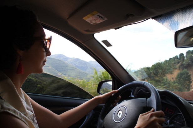
We cruised east, into the hilly terrain of southeastern Minas Gerais, with the electro-synth of Kraftwerk buzzing in our ears. Pico da Bandeira (Flag Peak) gets its name from the last Brazilian Emperor, Dom Pedro II, who, the story goes, ordered a flag to be flown from its summit. An ambitious man he was.
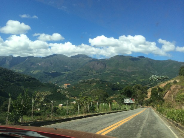
The mountain, and nearby peaks, is part of the larger Caparaó national park. The area around it is rural, but not particularly remote. Every few minutes along the roads we would pass some house, some farm, or more often, coffee plantations. There are only two entrances to the park, through the two “gateway towns” of Alta Caparaó, on the Minas Gerais side, or Pedra Menina, on the Espírito Santo side.
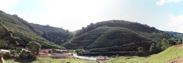
Now, in an area with abundant coffee production, hills literally covered in the stuff, in all directions, you would expect that a café would serve coffee. It’s in the name, right? Wrong. We were repeatedly unable to get a cup of local coffee to try, anywhere there, during our few days visit. Every café, every farm, only open on weekends. And not ready to open their doors and make an exception for us! For shame, lads. I didn’t even get a chance to try the most expensive coffee here, beans picked from bird poo, as selected by the Jacu bird. After eating the sweet outer skin, the beans pass through the bird’s interior, apparently unharmed. Being quite the connoisseurs, these birds choose only the finest beans, so later on you can get the best brew by picking them out of their shite. That’s the theory anyway, I’m yet to sample this product.
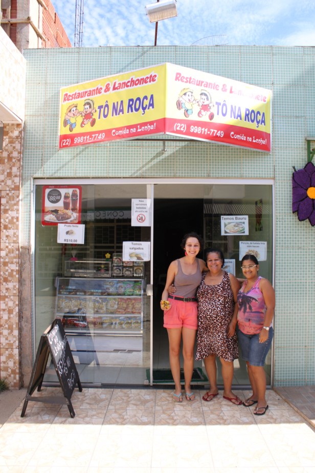
We got to Pedra Menina after sunset, looking for a place to stay. Fortunately, like any other small town in the world, everyone’s willing to help out the lost tourists. The supermarket referred us to the pub owner, whose wife runs a restaurant, Tô na Roça. The restaurant was closed! So she got a call, and re-opened especially for us. Nothing too fancy, a basic meal of chicken, rice and beans. Even better, after hearing our story, she offered us a room to stay for the two nights, next to the restaurant. We were her first paying guests, and for less than half what we were being charged elsewhere in town! She was pretty chuffed to have a real life Irish person in her restaurant too.
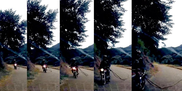
Next morning, the real work starts. Up at 5am for a quick breakfast, and up to the park entrance for 7am. On the way we met a motorcyclist with a death wish, carrying a length of rubber hose that whipped out and got stuck under our car, it could have easily pulled him off the bike.
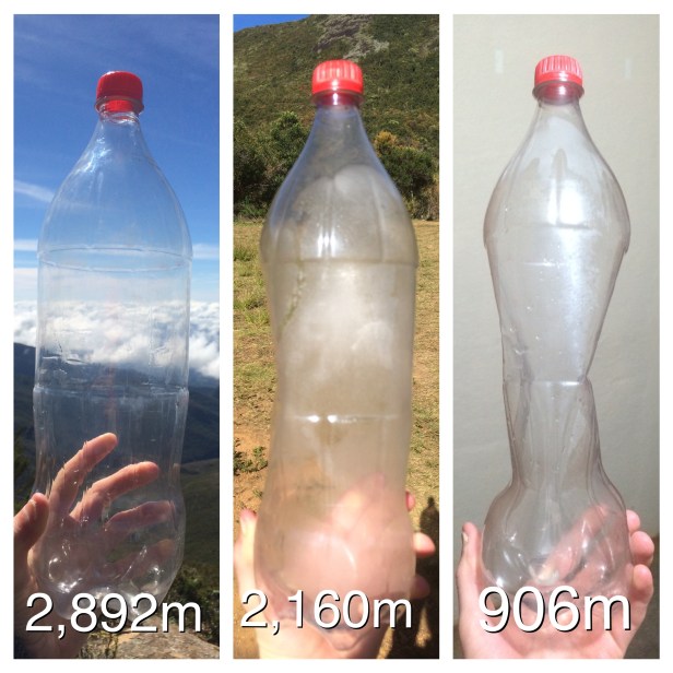
The rough road up to the car park took us from 1,400m at the entrance up to 2,160m at the road’s end, the campsite and car park Casa Queimada (Burnt House). Our engine struggled even in 1st gear, in the thin air.
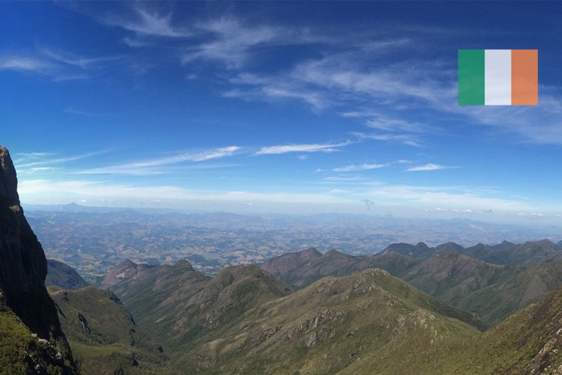
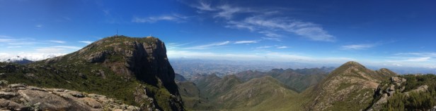
The well-marked trail takes the best part of 3 hours on the way up. It’s not difficult, it’s not too steep, but it’s windy, and before midday, bracingly cold. The most famous way to do this trail is to start at night, reaching the summit for dawn- we were a few hours too late for that, but the view was spectacular nonetheless. Hills over 100km away clearly visible, all the way to the Atlantic Ocean in Espírito Santo, and clear blue skies in all directions, well above the puffy clouds floating around far below us.
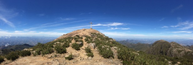
The summit is marked by a curious collection of:
- A crumbling cross, made from metal piping and reinforced concrete
- A statue of Jesus, riffing on the more famous Cristo in Rio
- A hollow metal tower, which we weren’t brave enough to climb.
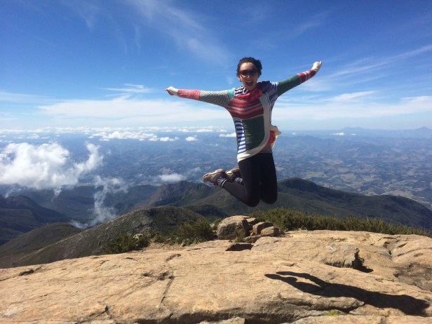
Appropriately, this being “Flag Peak” we whipped out our Irish and Brazilian flags to mark the occasion.

I also conducted a demonstration of the effects of air pressure:
Our return to base camp was as spectacularly uneventful as the way up. We took a break at a waterfall “Cachoeira da Farofa” to cool off in the icy water, and after leaving the park, came across this amazing road sign
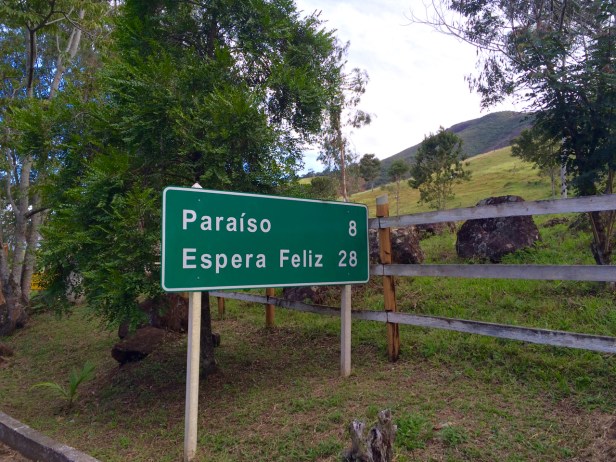
Espera Feliz means “happy wait”. And paraiso, is obviously “paradise”. But you don’t need to wait to be happy, since Paradise is closer. That’s just how it works in Brazil!


Final morning- time to go! Our host Adriana in the restaurant had told us to go visit a local farm, who had a captured wild boar, “a real monster” we were told. They still had him- but mainly in the freezer, cut up into bits. After fathering a few piglets with a normal sized female, he had become too aggressive and started breaking out of his pen, so it was time to turn him into pork. His jaw, which we got to hold, gives you some idea of his size:


The farm is part of Pousada Paineira, who produce several local products themselves: Cachaça, corn flour, rapadura (molasses sugar), amongst other things. The owner gave us a tour herself.

With that final stop, we bid farewell to the mountains, farewell to Minas Gerais and Espírito Santo, and prepared ourselves for a serious change in scenery. Finally we were going to Rio de Janeiro.
Prices
National Park admission: R$30 / €7.50
